
CANE BELT RAILROAD
The Cane Belt Railroad was soon purchased by Gulf Coast and Santa Fe Railroad [G C & S F RR] and ran south to Long Point, Guy, SENA JCT [Junction with Texas and New Orleans Railroad], Mooredale and on to Wharton County to the New Gulf sulphur plant at Boling.The Cane Belt Railroad built a line from the Thompsons Switch community in 1930.
The line parallel to FM 1301 was actually a Southern Pacific branch built under the
name New York, Texas, & Mexican - road the SP acquired control of it in 1885
which ran from Rosenberg to Victoria. Construction began in 1903, almost 25
years prior the development of New Gulf, and circled E, SE, S, SW and finally W
into Bay City and ended in (Tres) Palacios. Once New Gulf was formed, Texas
Gulf Sulphur wanted to avoid monopoly freight rates and the case went to the TX
RR Commission (when it actually performed railroad related duties) with SP,
Missouri Pacific (StLB&M) and Santa Fe (Cane Belt) all competing (SP trying
to justify their monopoly and the others wanting a piece of the pie). The RR
commission found in favor of the Santa Fe and so the Hall District was
constructed between Cane Jct (near Hwy 60) to Thompsons TX in 1930-1. This was
the final extension under the Cane Belt name.
The railroad track going Southwest form Thompsons Switch went to New Gulf to the sulphur plant at Boling Texas. There used to be a train everyday that would come through Thompsons carrying sulphur to Galveston. Uncle John Lundell, Uncle Lee "Buddy' Lundell, and Weems Moller used to go there every Sunday to play Golf. It was the only golf course around in the forties and early fifties. I used to go with them and mess around.
Huge pieces of sulphur spilled from the train along the main tracts in Thompsons. We would gather the sulphur, put it in Coke bottles. Then we would heat the sulphur until it reached a liquid state. When it cooled we would break the bottle and have a sulphur Coke. Not a great idea now but fun then. By dumb luck we never burned ourselves.
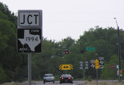
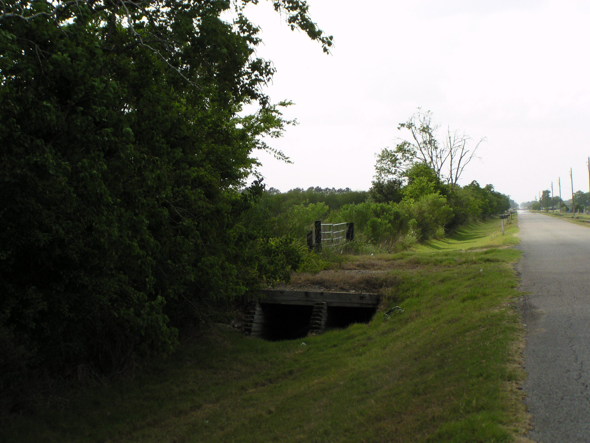
FM 762 crosses the old Cane Belt Railroad roadbed just east of the intersection of FM 762 and FM 1994.
Looking toward Thompsons Switch from FM 762 just east of the intersection with FM 1994
FM 1994 runs parallel to the railroad roadbed on the west side ot the roadbed from FM 762 to Long Point, Texas.
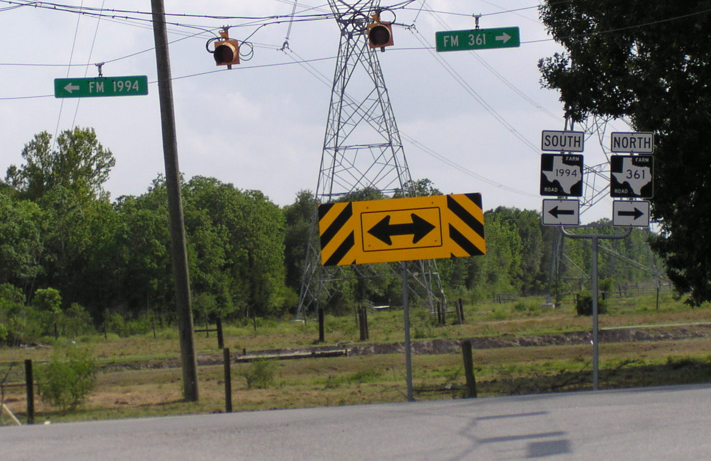
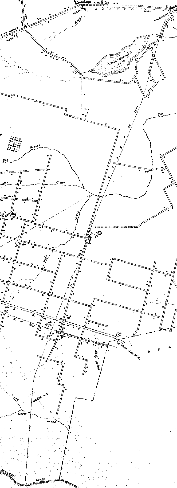
Welcome to Long Point, Texas. Turn East [left] to cross the railroad roadbed.
FM 1994 crossed the Cane Belt Railroad roadbed at Long Point, Texas
If you turn left you will enter the Sulphur plant. There will be a lake on your right that marks the spot the Sulphur wells were. After the Sulphur was melted underground with boiling hot salt water it was pumped to the surface and allowed to cool [harden] in an area the size of a city block. Actually the block of sulphur was divided in half with three inches deep Sulphur cooling on one half while the other half was filled. Tubes were placed to allow dynamite chambers used when the large block of pure Sulphur was blown apart for shipping. The lake occured by subsidence after the Sulphur was removed below it.
FM 1994 turns right after crossing the roadbed. Again it follows the roadbed but on the opposite side.
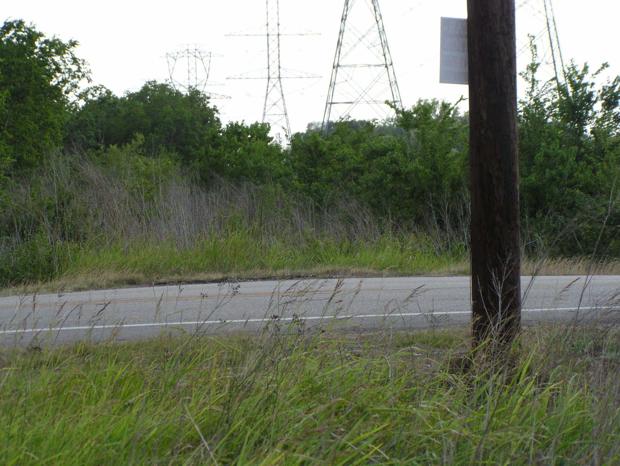
If you turn right on Zamanek Rd. there will be the RR roadbed crossing within 1,000 feet.
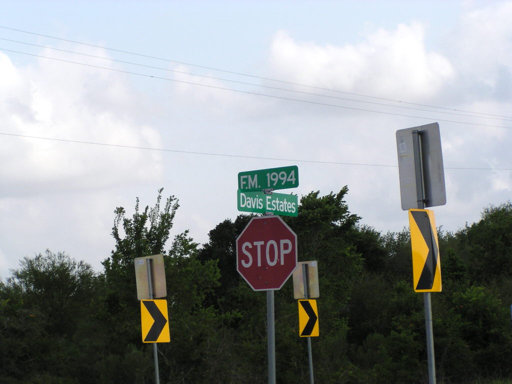
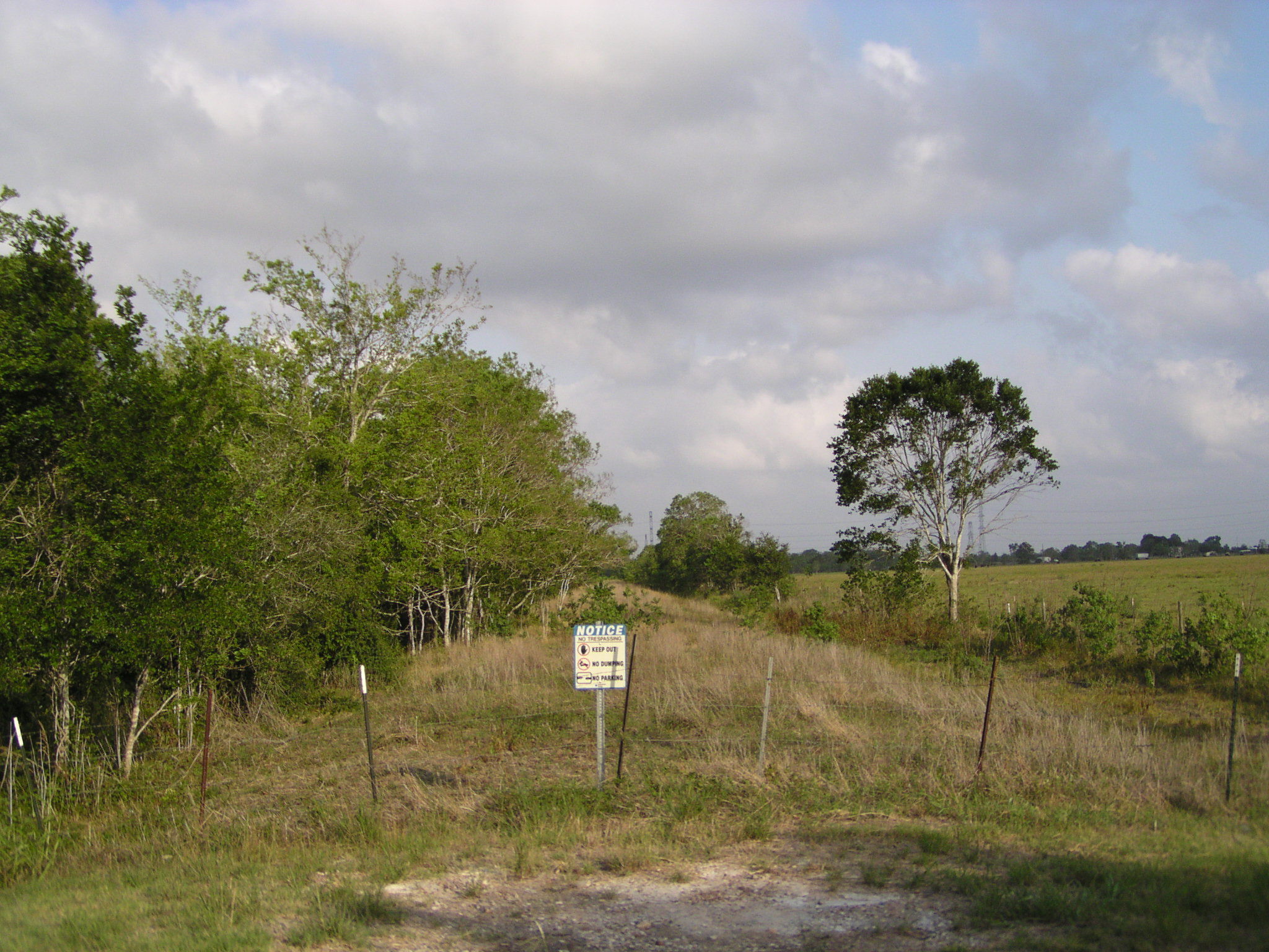
To follow the Cane Belt roadbed, to the south, you must return and continue on FM 1994 [Long Point, Guy Rd] to Guy. After crossing State Hwy 36 the road becomes Vrlla. The first road to the left is Marek, and should you turn left the old Damon railroad roadbed will be on your left. Stop here and you can line up where the SENA Junction was by looking behind you.
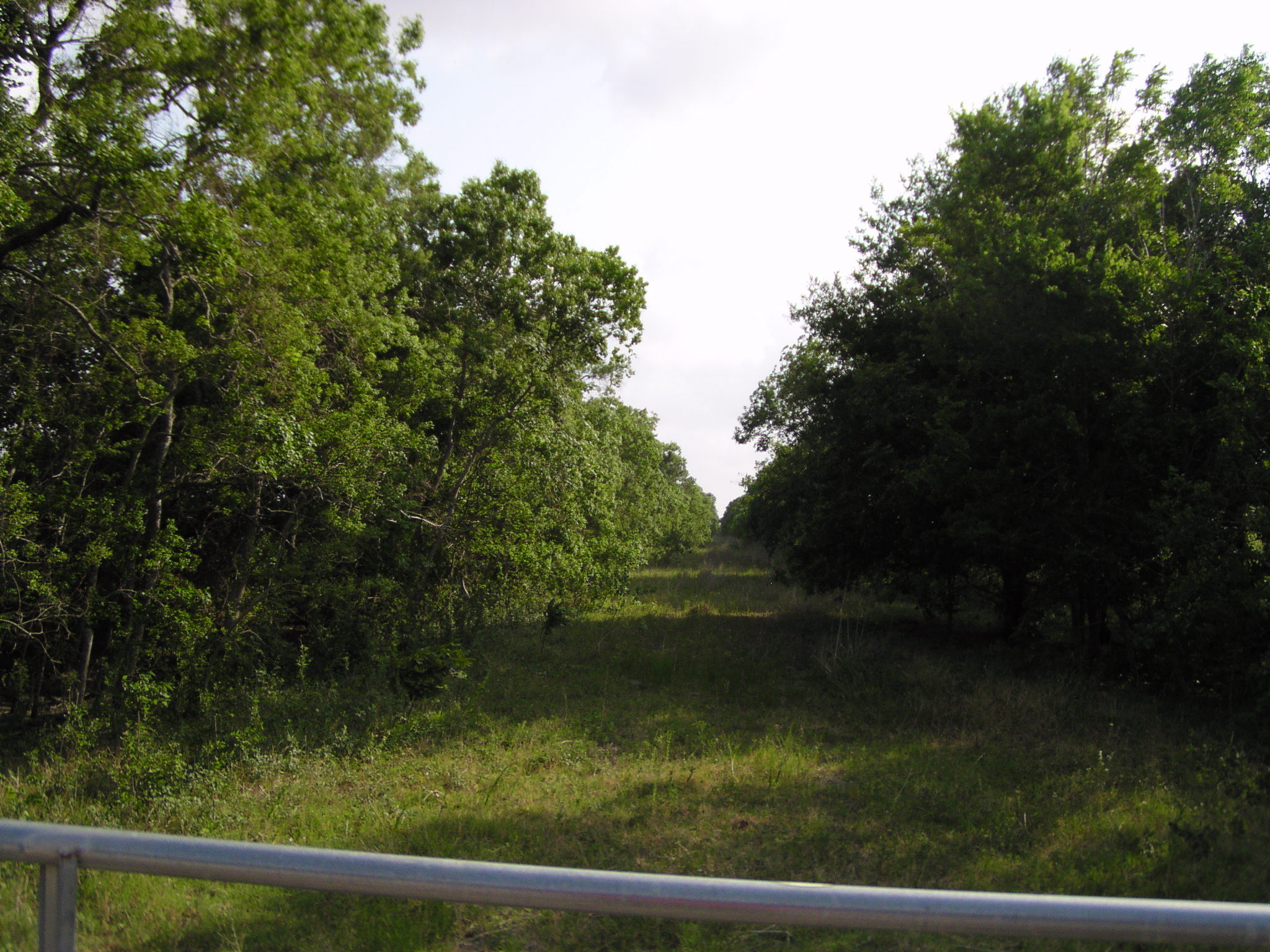
This picture of the old Damon railroad bed was taken across the Cane Belt railroad bed from Marek Rd. The next road towards Rosenberg from Guy is Walek Rd. So this picture is facing towards SENA Junction and Damon.
The Cane Belt railroad continued to the town of MOOREDALE, TEXAS before it crossed Cedar Creek. The RR continued on to New Gulf Sulphur at Boling Texas and Y'ed with another RR at Lane City.
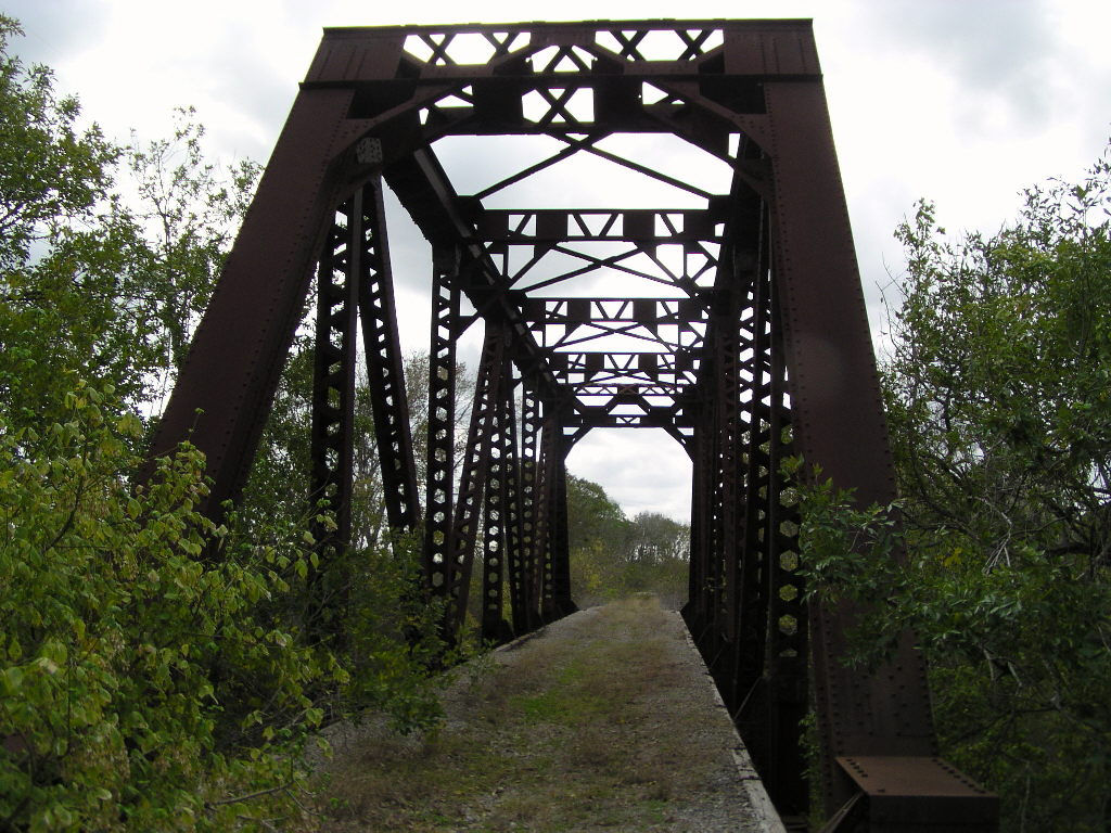
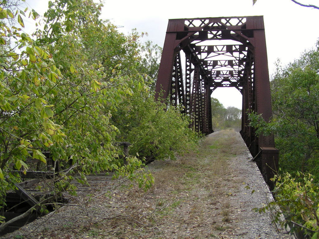
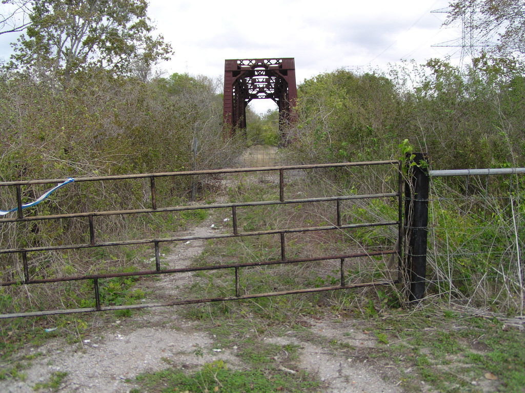
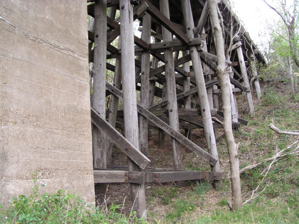
Below are photos of the bridge across the San Bernard River.
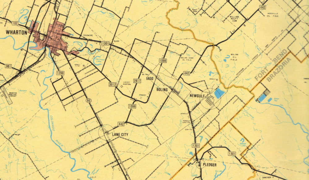
Above is the route of the Cane Belt RR through Wharton County.
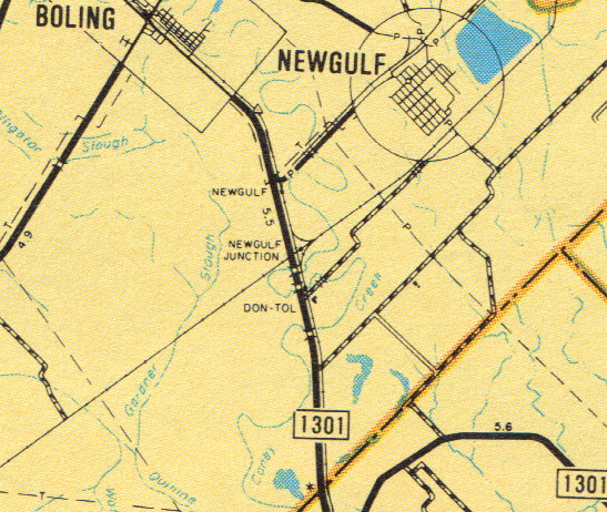
Notice the Y at NEWGULF JUNCTION. These Y's were important in the days of steam locomotives because the locomotives only pulled from one end of the engine. You see, you had to turn the entire train around for the return trip, and you could do this only with a Y. With today's locomotive there is the ability to pull from both ends of the locomotive. This allows the engine to park the train on a siding and use the main line to travel to the other end of the train for the return trip.
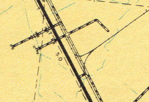
This is CANE JUNCTION, located south of Lane City in Wharton County. HWY 60, the road shown to the west of the Y junction, runs between the towns of Wharton and Bay City.